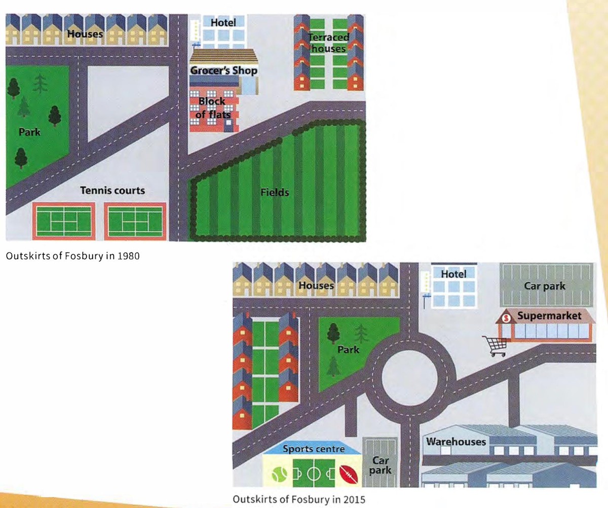
These maps illustrate the changes in the city of Fosbury from 1980 to 2015.
The changes show that while the green place was knocked down and Industrially was developed and also in the middle of the map all the roads were connected and developed for each place.
Terraced houses were relocated to the other corner of the city and also where this park teared down and developed a new park a bit smaller.Sports centre had a modernisation for more sports and connected to the main road and the other side of the place the car park was built. In the right side of the city, a Block of flats was removed and Grocer’s shop relocated and developed like a Supermarket and also a car park was developed near the Supermarket.Warehouses were developed for where the removed green fields from 1980.
To sum up, There were many changes during the 35 years in Fosbury such as industrially, commercially and recreationally.